Rough days on the South Atlantic10/4/2011 As mentioned on my previous post, we had some rough days when crossing the South Atlantic. In this video you can see Raghu falling over when the boat heads up during a strong gust and I show up driving at 1:26 when a big wave hits the boat. On the video below you can see some of the big sweells we were heading. So
2 Comments
Wildlife in Cape Town10/4/2011 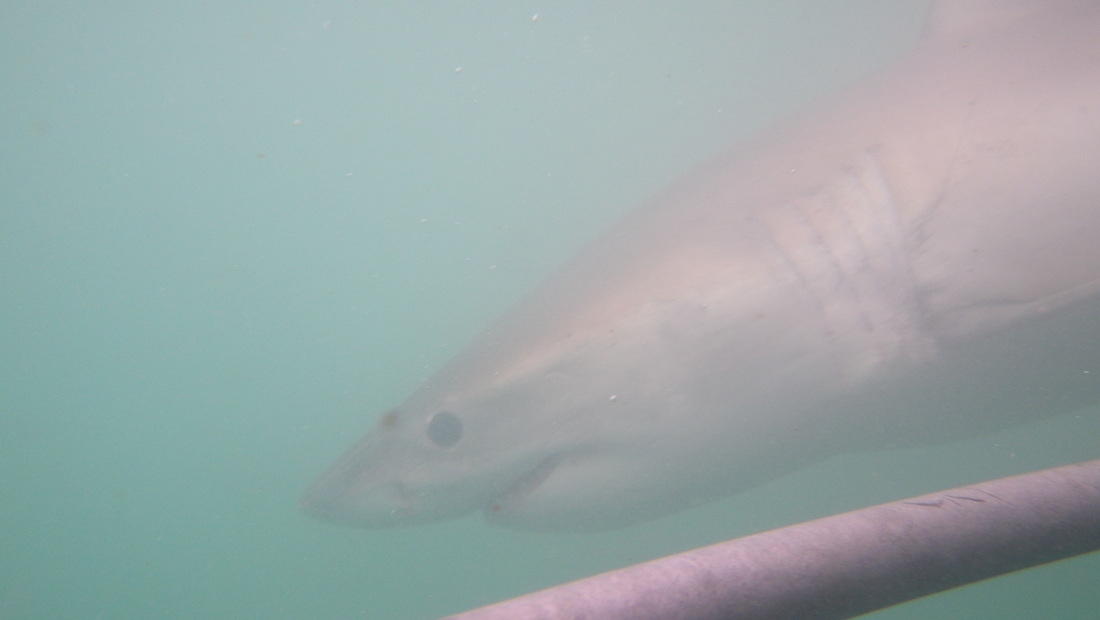 A friendly white shark swimming by me. One of the great attractions of Cape Town is Nature. Not only the landscape is amazing, with lots of beaches and mountains by the sea, but also the wildlife. I went cage diving with white sharks in Gansbaai, 2hs by car east of Cape Town. It was great, just like on TV! They use fish heads as bait to attract the sharks right close to the cage. I also climbed Table mountain, where you have amazing views of the city, the cape and the sea. Unfortunately I did not have much free time for sightseeing, due to race preparations. I also really enjoyed the food here. There are great restaurants! I have to come back to Cape Town!
I was on the news in Brazil!10/4/2011 When I was in Rio, I was interviewed by Nautica, the main Brazilian boating magazine. You can read the article here (in Portuguese) Nautica magazine and another one here 360 Graus.
 Sailing in the South Atlantic We left Rio on a Saturday, September 10th at 1400. The entrance of Guanabara bay is quite narrow and just when the fleet was crossing it, a big ship was coming in! I can imagine how surprised the pilot was when he saw 10 sailing boats heading towards him. The ship started to blast her horn non-stop, it was quite dramatic! The whole fleet decided to tack away, except us. We crossed the ship and tacked close to Santa Cruz Fort.
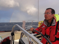
The great circle (the shortest distance between two points on a sphere surface) between Rio and Cape Town passes through the center of the South Atlantic High Pressure zone, an area that usually has light winds. Therefore there is a tactival trade off; stay close to the great circle and sail a shorter distance, but possibly into lighter winds or head more south and get stronger winds but sail a longer course. Some of the boats stayed closer to the great circle and others headed more south. We decided to sail in between and adjust our tactics along the way. When we left Rio, the GRIB files showed that we would pass through the northern part of a low pressure system that was moving from west to east below latitude 40 South. I don't think anyone was prepared to what we got! For 3 consecutive days (Sept 16 - 18) we were hit by a series of squalls with gusts over 40 knots, we had 25 to 38 knot winds, big seas with waves up to 20 ft (7 m) and to make things worse, we were heading upwind! The boat was constantly pounding, water all over the deck, everything getting wet! The South Atlantic decided to show its teeth! I've sailed through bad weather before, but usually it was just for a couple of hours and at night I was always in a safe harbor. This was a new experience to me; three consecutive days of bad weather! You don't get much sleep, you get tired, you get wet all the time and to move around in the boat is a challenge. Things start breaking and some of them we have to fix on the spot. The bilges keep filling up with water and we have to keep pumping out. As an example, on the second day of the storm, when it was already dark and at the last 30min of my watch, the yankee sheet broke. I was driving when it happened. We tacked and then the skipper took over the helm. I, Martin, Loyd and Roberto had to go to the bow to take down the yankee. It was a big challenge! The apparent wind was 25 knots, the bow was jumpimg up and down and we were constantly being washed by waves. We had to fight to tie down the yankee. When we finally came back to the stern, the skipper noticed that the wind had thrown the yankee over the lifelines. We had to go back and tie it down to the deck. During these days I have also experienced the most challenging driving up to now. One night when I took the helm, it was a constant strugle to keep the boat on course and avoid it rounding up (heading into the wind). The main sail was already on reef 2, but it was time to move to reef 3. When a squall approached and the gust hit 40 knots, the boat rounded up and she did not want to bear away, even though I had the wheel turned all the way to port. We stayed head to wind, heeled and with the main sail flogging for a good one minute. Finally I was able to bear away, but after that the skipper came on deck and we put the third reef. It wasn't easy! The skipper hanging to the mast to hank on the reef, the boat pounding, spray everywhere... Welcome to ocean racing! We have also experienced very big swells. At their peak I would say that they were from 15 to 20 feet high ( 5 to 7 m). In order to minimize pounding when I was driving, I head up when going up the swell and beared away when going down. The skipper Gareth, Adrian and Ian had to take down the storm jib and it was very hard! After 3 days of heavy weather, we finally left the low pressure system and started sailing towards a high pressure zone. The sun showed up, the wind came down and the seas calmed down. The crew morale improved and we started to clean up and fix the boat. We pumped out lots of water from the bilges and lazarette, took cushions and sleeping bags out to dry in the sun and fixed some instruments. It is amazing how things break down fast when the weather goes bad. It is a lot of pressure and a lot of tension for too long! Some of the wave pounding is so loud that it seems that the boat will split in half! No wonder you need a very sturdy vessel to safely cross the oceans. We were now close the Tristan da Cunha islands; a set of volcanic islands where lives the most remote community in the world! The closest city is Cape Town 1500 NM away. It is a British protectorate where only 300 people live, descendants from the first habitants who came 200 years ago. The South Atlantic pilot guide says that it is a place stopped in time, well worth a visit. Unfortunately we passed 30 NM away and we could not see it. Edinburgh boat sailed much closer and the skipper described the Inaccessible island, an island surrounded by cliffs 350 feet high, as "something out of myths and legends". It must be a sight to see! A new tactical decision had to be made; head north closer to the great circle or south towards the islands. Going north would bring us back to head winds again. Heading south would bring us to the westerlies and downwind sailing. We decided to head south.Two other boats did the sane, Welcome to Yorkshire and Singapore. The next couple of days sailing was beautiful! Sunny, but a bit chilly, good 15 to 20 knots winds, calm seas and we got lifted and passed north of the island. We were heading now east towards Cape Town. However our tactics did not work! After passing Tristan da Cunha, we hit a wind hole for 18 hs (avg speed 4.5 knots), while the boats at north had good wind. That was a killer! The strategy of going south wasn't working and we decided to head north. The wind filled in and backed and then we started heading east, straight to Cape Town. We were reaching on 30 knots fo winds, making an average of 11 knots. At this point we were 7th. We sailed east for 5 days, straight towards Cape Town. WTY was in 8th and they kept sailing a bit faster than us and getting closer. They won the ocean sprint (we were second by 30 min difference) and headed more south than us. On the last day, when we had 200 NM to Cape Town, they ended up having a better angle and passed us. We arrived in Cape Town on Thursday at 0600 in 8th place, after 18 days of sailing accross the South Atlantic.  Sugar Loaf in Guanabara bay, Rio de Janeiro We stayed only 72 hs in Madeira and on Friday August 10th at 1630 we started again. This leg was very tactical! We had to cross the equator, where there is always a band of light winds known as the doldrums. This band is usually located between 5 and 15 degrees north and it oscilates. The trick is to minimize the time spent in this area. If you are sailing south, you want to cross the doldrums in the region where it is moving north.
The whole fleet stayed together heading south, passing west of the Canary Islands. The next set of islands was Cape Verde, located just off the coast of Africa at latitude 15 degrees north. This is where the fleet spread. You can either sail west of Cape Verde, through the islands or east of them, along the coast of Africa. Traditionally the doldrums are narrower west of Cape Verde. If the wind is right, there can be a funnel effect through the islands, speeding up the passage. However there is a risk of the wind dying and the boat getting stuck in a big wind shadow due to the islands mountains. During summer there is the phenomena of the "Africa monsoon"; due to the Sahara heat, there is a steady breeze blowing onshore along the coast, and this can favor a route east of the islands. There are a lot of factors at play when making the route decision. Every morning all the boats receive a file via email called GRIB. This is a data file with wind forecast in our area for the next 5 days. It is based on measurements and metereological models and it is freely available on the internet, produced by NOAA (National Oceanic and Atmospheric Administration). After studying the file we reached the conclusion that sailing east of Cape Verde, along the african coast, would be the best option. We were getting good wind due to the monsoon and it was forecasted light winds west of the islands. The rest of the fleet headed west while we were the only boat that kept heading south. We dropped positions on the fleet and people started wondering where we were going. We had good wind and we were confident that our strategy would pay off! The plan was to sail south until the latitude of Dakar in Senegal (10 degrees North) and then start heading southwest. The whole fleet would be stuck in a hole while we would climb up to the top. Well, that was the plan on paper, but in reality things were different. Our strategy depended on the rest of the fleet being stuck in light winds while we would get stronger winds; that would compensate the additional miles that we had to sail by going down the coast. However the GRIB files are not 100% accurate. What happened is that the wind filled up fron the north over Cape Verde and 3 boats, Gold Coast, Singapore and Welcome to Yorkshire, benefited from the funnel effect; they got a boost ahead of us! To make things worse, we hit some light wind during one day and one night. We were now in 4th place. There is an old sailing tradition of comemorating when crossing the equator for the first time. You make a ceremony in honor of Neptune and have a drink. We did a ceremony on the boat where Loyd dressed as Neptune, Victoria as Neptunes's wife and Sue as a mermaid. It was very funny! As a passing ritual 3 of us shaved our heads, including me! Short hair is much easier to deal with on a long voyage on a boat. After the equator we passed close to Penedos de São Pedro e São Paulo and the arquipelago of Fernando de Noronha, but we were too far to see them. We got close to the coast of Brazil around Recife, then we sailed down the coast 200 NM offshore. It was easy sailing, beam reaching, sunny and warm. It was the final stretch to Rio! At the southern part of Bahia, close to Abrolhos, we saw lots of whales; mothers and calves, breaching, swimming close to the boat. During winter these whales migrate from the southern ocean to the coast of Brazil to breed. It was a really cool sight! We saw the shore when we got 5 NM off Cabo de São Tomé, north of Campos bay. That night a low pressure system approached us from the south and we had rough seas and winds of 30 knots overnight. It was just like the storms in the Bay of Biscay! The last rought patch before arriving in Rio. On the next day the sky was cloudy and the wind was around 15 knots. The next and final waypoint was Cabo Frio, marked by a big rock, where the coast turns west. It is located 70 NM from Rio. After turning the cape, we sailed upwind and at night we started our approach to the entrance of Guanabara bay. 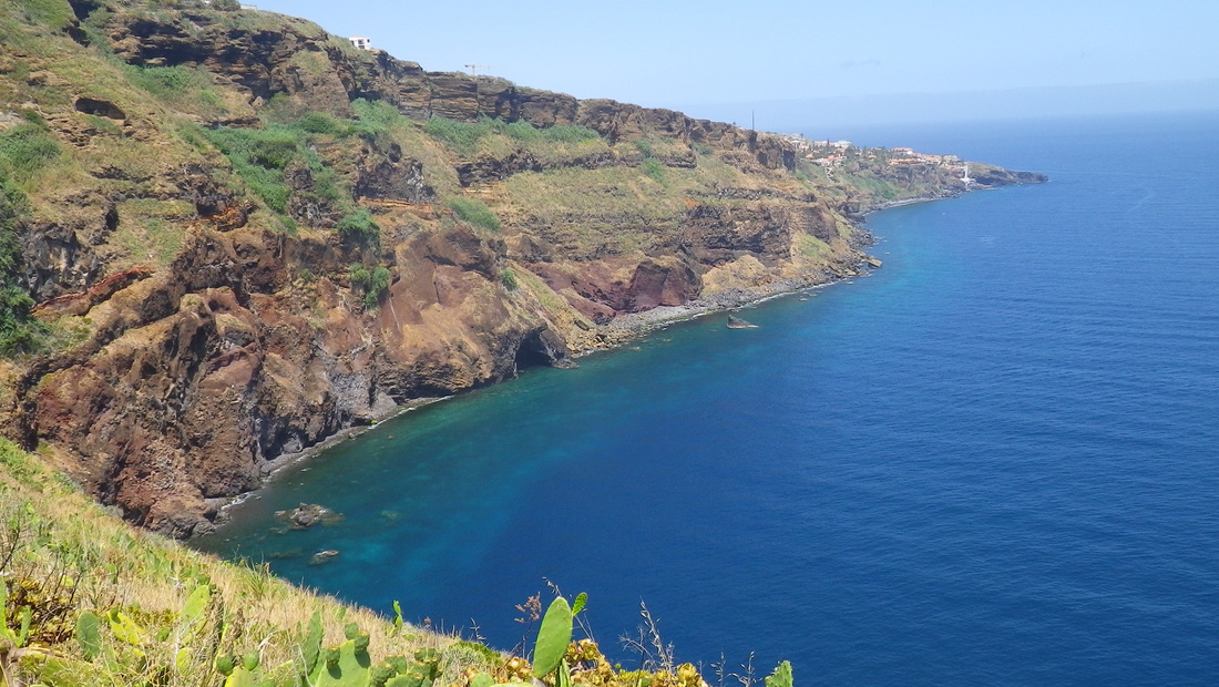 View of Madeira island On August 31st at 1630 we started the race. There was a big boat parade down the Southampton bay with dozens of private boats and yachts following us plus the navy ship HMS Intrepid just behind us. The starting line was in front of Cowes on the Island of Wight. The wind was strong, around 20 knots and we started heading east on the Solent.
On the first night the winds got very light. We were off the coast of France and we had to anchor to avoid being pushed back by the tide current. We put out over 100 feet of rode and luckily the anchor set. We hold ground until the tide reversed. On the Bay of Biscay we met our first depression. This bay is famous for its storms because it is the final destination of most low pressure systems crossing the North Atlantic. For 24 hs we had winds up to 35 knots and waves up to 3 meters. It was not comfortable in the boat! It was the same day that I had to be a mother (galley and cleaning duties) and I felt sick most of the day. Cape Finisterre marks the southern tip of the Bay of Biscay and we were happy to arrive there. We thought we would not meet another storm until Madeira, but another low pressure system came over. Not as severe as the first one, but we still had 30 knots of wind and big seas. After this storm we had only sunny, warm days and starry nights, downwind sailing with the kite all the way to Madeira. Happy sailing! We were match racing Visit Finland down the Spanish coast. They decided to stay close to shore while we tacked and headed offshore. They got lifted along the shore and got better wind and gained on us. Later GC headed for the shore also and eventually took over VF. We had two days of light wind and lost position to both of them. Derry was 50 NM behind us and we had to watch out not to lose our 3rd place. We spent 2 days in Madeira. It is a beautiful volcanic island, with lots of hills and mountains.The airport is built on a gigantic bridge along the water due to the lack of flat space! Their seafood is very good and a famous dish is Espada fish with banana. It is a great place worth a visit when crossing the Atlantic. |
